Mount Damavand Campsites
Damavand Camp
For trekking and ski touring, there are 10 camps and shelters located on Mount Damavand, Iran. These mountain campsites and refuges, which are positioned in key spots along the 4 routes to Damavand summit, give climbers a chance to unwind and acclimate to the altitude. We'll give you a complete introduction to Damavand camps, mountain huts, shelters, and tenting spots in this topic, along with information on where they are and an overview of the safety precautions for climbing and ski touring to Damavand from different routes and spending the night there.
1- Polour Camp
2- Rineh Camp
3- Gosfandsara Shelter
4- Bargah Sevom Shelter
5- Bargah Sevom New hut
6- Simorgh Shelter
7- Takhte Feridoun Refuge
8- Nandal Mountaineering House
9- Damavand 4000-Shelter
10- Damavand 5000-Refuge
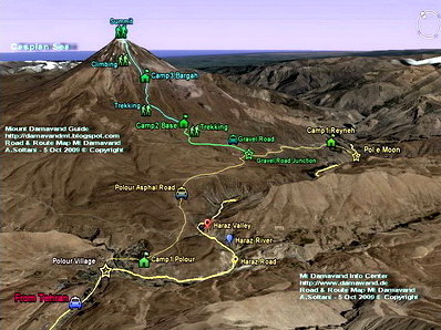
Mount Damavand Map
Damavand South Route Map
Download the full size image in jpg format.
Damawand Map1: Download
Damavand South Route Resorts
The south route of Damavand is the most comfortable and favorite face for climbing, skiing and snowboarding, find some info about the camps located on this side.
Damavand Camp 1 Polour Complex Campsite 2270 m - 7,447 ft
Polour Camp is the best starting point for the south and the west route of Mt Damavand.
How to go there:
Tehran > Haraz Road > Polour village > Polour Camp. (approx 2 Hours)
If you travel from Tehran, Polour is a shortcut to the mountain. It is a new established resort made by Mountain Climbing and ski Federation of Iran.
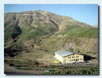
Mt Damavand Camp1 Polour
Note: Reyneh Camp is not recommended any more!
Tehran > Haraz Road > Reineh > Reineh Camp (approx 3 Hours).
Damawand Camp2 Base 3040 m - 9,973 ft
Also called Goosfand Sara Shelter or Mosque.
In winter you can not go you to Damavand Base Camp by car, because the gravel road is covered by snow and ice, so you have to start your climb from the gravel road junction. Visit also Damavand Warning.
Damawand GPS Landmarks
5- Gravel Road Junction
Begining of gravel road to basecamp, in winter you should start climbing from this point.
The gravel road to basecamp is covered by snow and ice and it is imposible to use car.
If you travel either from Tehran or north of Iran, you will come to this junction anyway.
Altitude 2458 m
Latitude 35-52-47 N
Longitude 52-07-16 E
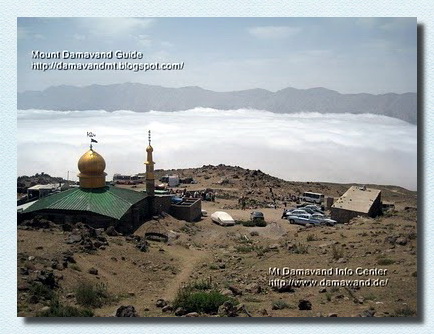
Damavand Camp2 Base
In winter By 6 to 8 hours climb you reach the Bargah-e Sevom New Hut, you may carry heavy equipments yourself or use porters. No foot paths are visible, it is not easy to find them, if you start in the morning you have enough time to reach the camp in time, use the day light only, never start in the darkness. Visit also Damavand Weather Forecast.
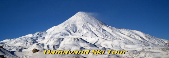
Damavand Ski Touring
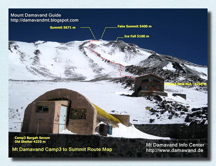
Damavand Camp3 Old Shelter and the New Hut
Damavand Base Camp
Goosfand Sara Campsite, or Damavand Base Camp, is the most straightforward and famous launch site for Mount Damavand treks in Iran. Set at 3,040 meters elevation, it includes a modest mountain refuge, the Saheb al Zaman mosque, and a sheepfold. This base camp is the main gateway for summer treks up the south route, located at 35.9020° N latitude and 52.1094° E longitude.
The Definitive Guide to Mount Damavand: Stats, Location, and Interesting Facts
The Definitive Guide to Mount Damavand offers a thorough look at Iran’s tallest mountain. At 5,671 meters, it holds the title of the highest peak in the Middle East and is an important geographical landmark. This guide provides detailed statistics about Damavand’s height, location, and geological structure. It also covers fascinating facts about its volcanic activity, climbing challenges, and cultural significance, offering a unique perspective on why this mountain is considered one of Iran’s greatest natural wonders.
Damavand Campsites 24DST1216C
All Rights Reserved. © Damavand Ski Tour
All the material on this website is protected by copyright.
